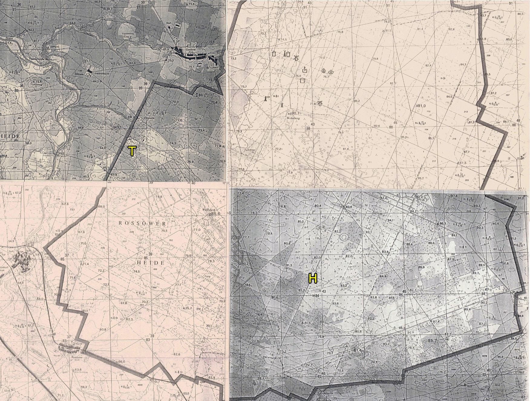
On distingue bien sur cette carte topographique du polygone de Wittstock l'aérodrome factice et à sa gauche la grille de l'objectif n°100 composé de cibles destinées au tir canon ou roquettes non guidées.
Le "T" représente l'emplacement de la tour de contrôle et de tours d'observation de la zone du complexe réservée au tir air-sol. Les petits symboles pointus au-dessus du T représentent les tours. L'hélipad n°091 était situé à proximité.
Le "H" indique l'emplacement de l'hélipad n°364 et le symbole pointu au-dessus montre l'emplacement de la tour d'observation de l'aérodrome cible.
This topographic map of the Wittstock firing range clearly shows the mock airfield and, to its left, the grid pattern for Target n°100, composed of targets intended for cannon or unguided rocket fire. The "T" indicates the location of the control and observation towers of the air-to-ground firing range. The small pointed symbols above the T represent the towers. Helipad n°091 was located nearby. The "H" indicates the location of Helipad n°364, and the pointed symbol above it indicates the location of the target airfield observation tower.