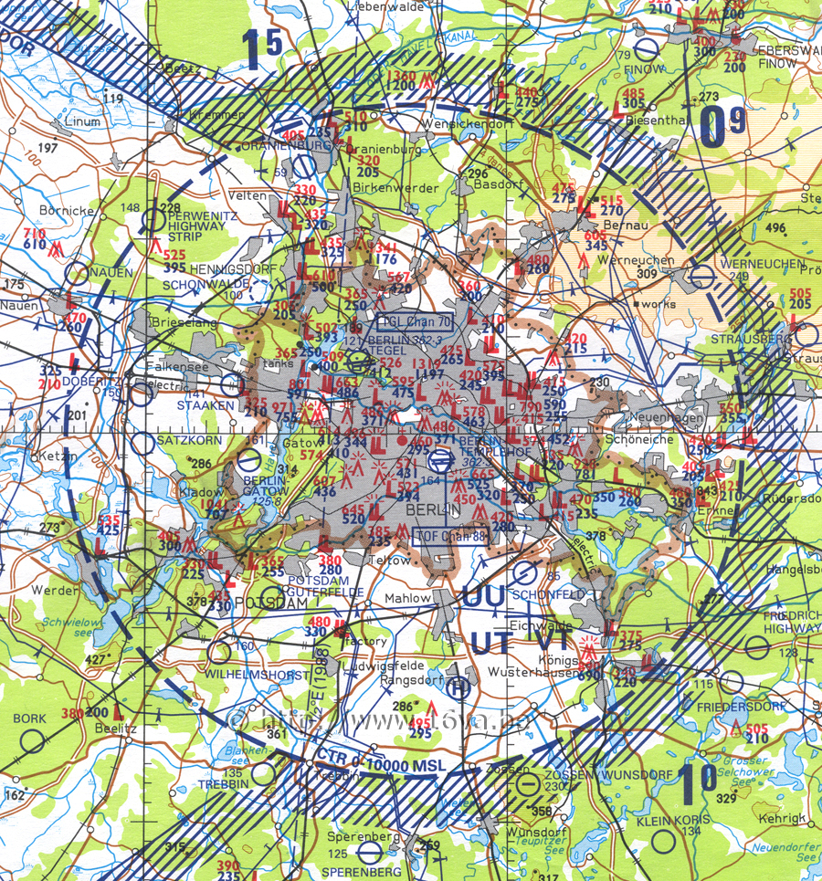
Ce fragment d'une carte de navigation aérienne datant de 1988, illustre parfaitement la "Belin Control Zone". A gauche, on distingue la zone où fusionnaient les trois couloirs de Berlin, juste avant d'aboutir dans la BCZ. Zerbst et Köthen étaient dans le couloir sud, tandis que Mahlwinkel était localisé dans le corridor central. Il n'y avait pas de base aérienne importante dans le couloir nord. Werneuchen se situait au nord-est de la BCZ, juste sur le bord, tandis qu'Oranienburg était au nord-nord-ouest. La BCZ englobait également Rangsdorf, au sud.
The Berlin Control Zone is clearly visible on this low level flying chart dating back to 1988. On the left, one can see the area where the three Berlin air corridors merged together, just before the BCZ. Zerbst and Köthen airbases were inside the south corridor and Mahlwinkel inside the central corridor. There was no important airbase inside the north one. Werneuchen was situated at the north-east of the BCZ, just on the edge and Oraninenburg was located NNO of the BCZ. Rangsdorf was also inside the BCZ, to the south.